


Munro Bagging

Beschreibung von Munro Bagging
Munro Bagging is an application that allows you to browse through all of the significant hills in Britain, including the Munros, the Murdos, the Grahams, Marilyns and Corbetts.
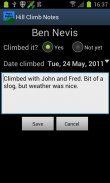
As well as providing information on each hill (useful for walk planning), you can record notes from when you climbed it.
Features:
- Search for hills by name
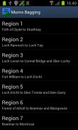
- List hills by name, height or region
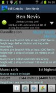
- See information on hills' classification, height, prominence, location, summit features and useful Ordnance Survey maps
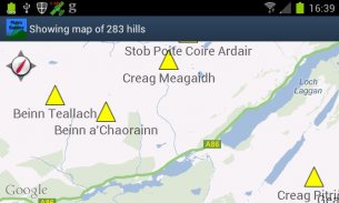
- View hill location on a map, either individually or all together
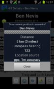
- Get bearing and distance from the phone's current location to the hill summit
- Audio pronunciations of hill names, via the optional Munro Bagging Sounds extension application
Features to come:
- Import/export climb notes to file, to allow migration between phones
- Integration with photo albums
- Social media integration ("share my climb")
Uses data from the Database of British and Irish Hills (<a href="https://www.google.com/url?q=https://www.google.com/url?q%3Dhttp://www.hills-database.co.uk/%26sa%3DD%26usg%3DAFQjCNF5WWSxNsuEG8kmL2Q-f1gsadAJEA&sa=D&usg=AFQjCNHS1qF4GFX0vmksxt-RDOdc7g7A6Q" target="_blank">http://www.hills-database.co.uk/</a>), licensed under Creative Commons 3.0.
Audio clips supplied by and used with kind permission of Comunn na Gàidhlig (CnaG) (<a href="https://www.google.com/url?q=https://www.google.com/url?q%3Dhttp://www.cnag.org.uk/%26sa%3DD%26usg%3DAFQjCNGXmnIk-wTCvGOwlklmmfvgxI20Jw&sa=D&usg=AFQjCNFOeR-ZRMwLFdmOOdZnc0j-Cb6-iA" target="_blank">http://www.cnag.org.uk/</a>)
</div> <div jsname="WJz9Hc" style="display:none">Munro Bagging ist eine Anwendung, die Sie durch alle bedeutenden Hügel in Großbritannien, einschließlich der Munros, die Murdos, die Grahams, Marilyns und Corbetts durchsuchen können.
Neben der Bereitstellung von Informationen über jeden Hügel (nützlich für Fuß-Planung), können Sie die Noten aus, wenn Sie es kletterte aufzeichnen.
Features:
- Suche nach Namen für Hügel
- Liste Hügel nach Name, Größe oder Region
- Hinweise auf Hügeln 'Klassifizierung, Höhe, Prominenz, Lage, Gipfel Features und nützliche Ordnance Survey Karten
- Blick Hügel Standort auf einer Karte, entweder einzeln oder alle zusammen
- Holen Sie sich Richtung und Entfernung vom aktuellen Standort des Telefons auf den Hügel-Gipfel
- Audio-Aussprache der Namen Hügel, über die optionale Munro Bagging Klingt Erweiterungsantrag
Features zu kommen:
- Import / Export-Aufstieg fest in die Datei, um die Migration zwischen Handys können
- Integration mit Foto-Alben
- Social-Media-Integration ("teile meine climb")
Verwendet Daten aus der Datenbank der britischen und irischen Hills (<a href="https://www.google.com/url?q=http://www.hills-database.co.uk/&sa=D&usg=AFQjCNF5WWSxNsuEG8kmL2Q-f1gsadAJEA" target="_blank">http://www.hills-database.co.uk/</a>) unter Creative Commons 3.0 lizenziert.
Audio Clips nach geliefert und mit freundlicher Genehmigung von Comunn na Gàidhlig (CNAG) verwendet (<a href="https://www.google.com/url?q=http://www.cnag.org.uk/&sa=D&usg=AFQjCNGXmnIk-wTCvGOwlklmmfvgxI20Jw" target="_blank">http://www.cnag.org.uk/</a>)</div> <div class="show-more-end">


